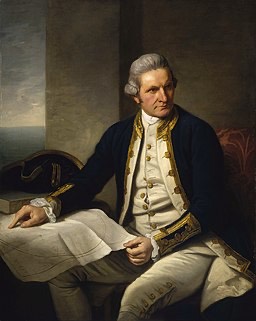
English explorer, navigator and cartographer James Cook (1728-79) was born at Marton-in-Cleveland in Yorkshire, the son of a Scottish agricultural labourer.
After his father's employer covered the cost of five years' schooling, he spent eighteen months working for a grocer and haberdasher in the fishing village of Staithes.
When that line of work proved unrewarding, he switched to a three-year apprenticeship with Whitby ship-owner John Walker. The latter owned colliers working in the English coastal and Baltic trade.
Besides learning the basics of his profession as a seaman, Cook studied astronomy, mathematics and navigation.
After passing his examinations in 1752, Cook progressed through the merchant navy's ranks. In 1755 he was the mate aboard the collier Friendship when Walker offered him the chance to command the vessel.
However, Cook rejected the offer and joined the Royal Navy as an able seaman just before the Seven Years' War broke out.
The usual explanation for the change is that the service offered better career prospects and the chance of rapid advancement.
He was rated as Master's Mate within a month of boarding H.M.S. Eagle.
After two years in the English Channel, he passed the sailing master's examination. An appointment to the Pembroke, which crossed the Atlantic to participate in the siege of Louisburg in 1758. Cook then contributed to the survey of the St. Lawrence River entrance during the Quebec siege.
After the fall of Quebec, Cook transferred to the Northumberland and spent the next five summer seasons surveying the coasts of Nova Scotia and Newfoundland. He produced the first accurate large-scale charts to use precise triangulation. He continued his scientific studies while he wintered in England.
He continued the Newfoundland survey after he married Elizabeth Batts late in 1762 and received his first command (the Grenville) two years later.
His charts of Newfoundland waters and an observation of a solar eclipse brought him to the attention of the Admiralty and the Royal Society.
It was excellent timing.
The two bodies were looking for a commander to lead an expedition to the South Pacific to observe the transit of Venus.
Although the Royal Society favoured Alexander Dalrymple for the position, he was a civilian. Dalrymple had already identified the Whitby collier that became H.M. Bark Endeavour as a suitable vessel for the expedition when the Admiralty's First Lord, Sir Edward Hawke, intervened.
Hawke reputedly stated he would suffer his right hand to be cut off rather than allow a civilian to command a naval vessel. Dalrymple reacted with horror and withdrew from the expedition.
Cook's promotion from Master to Lieutenant gave him the status to command the 368-ton bark, which sailed from Plymouth on 26 August 1768. While the voyage's ostensible purpose was to observe Venus's transit, secret orders directed Cook to establish whether the long-supposed continent, Terra Australia Incognita, existed.
After a stopover in Rio de Janeiro, the Endeavour rounded Cape Horn, continued westward across the Pacific and arrived at Tahiti on 13 April 1769.
However, the observations of the Transit of Venus were not as conclusive or accurate as had been hoped.
Once they were complete, Cook's sealed orders for the second part of his voyage pointed him straight towards where Terra Australis Incognita was thought to lie.
After drawing a blank in that direction, Cook took the Endeavour to New Zealand. Over nearly five months (6 October 1769 to 31 March 1770), Cook circumnavigated New Zealand. He charted the entire coastline and conclusively proved that the islands were not the western coast of the fabled continent.
Given a choice of return routes, Cook opted to travel home via Australia's undiscovered east coast, Torres Strait and Batavia. He thought it might be possible to establish the location of islands sighted by Quirós nearly two centuries along the way.
So Cook headed west. The Endeavour reached the south-eastern coast of Australia on 19 April 1770 and followed it, charting the coast. On 29 April, she reached Stingray Harbour, where the expedition spent a week. Joseph Banks and his naturalists collected a large enough variety of specimens to justify renaming the anchorage Botany Bay. After a second landing at Bustard Bay and a third near Cape Townshend late on the night of 11 June, the Endeavour struck a coral reef near Cape Tribulation at high tide.
Two tides later, the ship was hauled off after ballast, cannons and anything they could spare had been jettisoned. The hole in the hull was fothered with an oakum-filled sail, and after three days, she was beached in the Endeavour River, the site of modern-day Cooktown.
Repairs and gales kept them there for seven weeks. When the work was complete, and the winds eased, the Endeavour continued her northward run. Cook found an exit through the barrier reef into the open sea but returned to relative safety within the reef under dramatic circumstances.
After rounding Cape York, Cook claimed the entire coastline he had just explored as British territory at Possession Island on 22 August. From there, satisfied that New Guinea and the coast he had named New South Wales were separate entities, he sailed for Batavia.
He arrived at the Dutch headquarters in the East Indies on 11 October. Further repairs and refitting kept him there until 26 December. Cook had got that far without losing a crew member to scurvy. Two months in Batavia was more than enough time for malaria, other mosquito-borne fevers and dysentery to take their toll.
Once the repairs were complete, the voyage continued via Cape Town and Saint Helena. The Endeavour was back in England on 13 July 1771. Cook had charted more than eight thousand kilometres of new coastline with incredible accuracy but had failed to find the presumed southern continent.
By circumnavigating New Zealand, Cook had established that it was not attached to a continental landmass to the south. Despite emerging evidence to the contrary, significant members of the Royal Society, including Alexander Dalrymple, still believed a massive southern continent would eventually be found.
Promoted from Lieutenant to Commander, Cook answered criticism that he had not done enough to discover Terra Australis Incognita on his second voyage (1772-75).
Cook's Resolution, accompanied by Tobias Furneaux's Adventure, circled the southern hemisphere in high latitudes without finding the fabled continental land mass.
So there was no continental land mass in temperate waters south of the known continents. Nor was there anything significant between them.
Cook crossed the Antarctic Circle and carefully investigated Antarctic waters. He systematically eliminated reported sightings and rumours on the way. His furthest south point (71° 10' S., in longitude 110° 54' W.) was uncomfortably close to the Antarctic mainland.
Along the way, in February and March 1773, the Adventure, having lost the Resolution in fog and gales, made for Van Diemen's Land's south coast. Furneaux renamed Bruny Island's Adventure Bay and sailed around the Tasman Peninsula and along Tasmania's east before proceeding to a pre-arranged rendezvous in New Zealand.
During the southern winter, Cook turned north towards the New Hebrides. He revisited New Zealand without meeting the Adventure and discovered New Caledonia and Norfolk Island on the way. In the process, he eliminated sightings others thought might have been part of Terra Australia.
He returned to Antarctic waters after revisiting Tahiti, charting Easter Island, the Marquesas, and Tonga. He rounded things off by discovering South Georgia in the South Atlantic. By the time he returned to England in 1775, he had covered some ninety-six thousand kilometres in three years.
Having the myth of Terra Australis Incognita to rest, Cook was promoted to Captain and given an honorary retirement from the Navy, with a sinecure at the Greenwich Hospital. He was now a Fellow of the Royal Society, awarded the Copley Gold Medal for the remarkable achievement of completing his second voyage without losing a man to scurvy, but remained restless.
Cook's third and last voyage (1776-79) took him to the Pacific coasts of North America and Siberia. He hoped to find the western outlet of the fabled North-West Passage, which was believed to connect the Atlantic to the Pacific around the top of North America.
Cook again commanded the Resolution, accompanied by Charles Clerke in H.M.S. Discovery. The official purpose of the expedition was to return Omai, a Pacific Islander who had travelled to Europe aboard the Adventure in 1774, to Tahiti.
Cook travelled to Tahiti via the Cape, Tasmania and New Zea\land, discovering several of the Cook Islands along the way. Once Omai was back in Tahiti, Cook went north.
In January 1778, he made landfall in Hawaii at Waimea harbour, Kauai, on his way to North America's west coast. He named the Hawaiian archipelago the Sandwich Islands after the acting First Lord of the Admiralty.
From there, Cook sailed north, then turned north-east to the west coast of North America's west coast, north of California. He made landfall in Oregon, unknowingly passed the Strait of Juan de Fuca, and entered Vancouver Island's Nootka Sound. The two ships remained there from 29 March to 26 April 1778, then moved north, charting the coast as far as the Bering Strait's Icy Cape.
When ice blocked further northward progress, Cook surveyed the Siberian coast, then returned to Hawaii in 1779 to winter there.
After sailing around the archipelago for two months, his arrival at Kealakekua Bay on the main island in January 1779 coincided with a harvest festival worshipping the Polynesian deity Lono.
A series of coincidences, including Cook's clockwise route around the island, may have caused the islanders to treat Cook as an incarnation of Lono.
Shortly after the expedition set sail a month later to resume the quest for the North West Passage, the Resolution's foremast broke. The ships were forced to return to Kealakekua Bay to repair the damage.
In the Cook/Lono version of events, this was a departure from the supposed narrative. However, there are many other explanations for what ensued.
The Islanders, friendly enough before the ships departed, had now become distinctly unfriendly. As tensions rose, quarrels broke out between the local people and their visitors.
After his men took wood from a burial ground, things turned ugly. The local people retaliated by removing a cutter from one of the ships.
Cook landed on 14 February, kidnapped the island's ruling chief, Kalaniʻōpuʻu and planned to hold him until the cutter was returned. When a scuffle broke out on the water's edge as Cook turned his attention to launch the boats, he was struck on the head and stabbed as he lay in the surf. Four marines died in the confrontation, with another two wounded.
Although the Islanders removed Cook's body and carried out rituals usually reserved for chiefs and island dignitaries, some of his remains were returned to the ships and formally buried at sea.
Charles Clerke took over as leader of the expedition, but a final attempt to pass through the Bering Strait was unsuccessful. John Gore, a lieutenant on Cook's first voyage, replaced Clerke when he died from tuberculosis on 22 August 1779. The expedition eventually returned to England in October 1780.
During his three voyages, Cook crossed thousands of kilometres of uncharted waters and charted coastlines in detail and on a scale not previously achieved. He displayed superb leadership, seamanship, surveying and cartographic skills, and physical courage. He left a scientific and geographical legacy which lasted well into the 20th century.